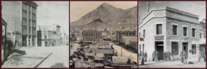
Tonopah is located about halfway between Reno and Las Vegas at an elevation of 6,047 ft.
Tonopah is a perfect place to stay while enjoying central Nevada’s recreational activities including rock hunting, hiking, bird watching, wildlife viewing, mountain biking, off-roading & hunting.
Because it’s so far from the bright lights of any major city, Tonopah’s night skies are considered among the best in the country for stargazing. Tour our Historic Mining Park & visit the Central Nevada Museum.
Go off-roading or visit nearby ghost towns. Shop in unique stores, discover local artists & even pan for gold during Jim Butler Days!
Community Profile
Population: Approximately 1,895
Location: West Central Nevada
Coordinates: Lat: 38.06722, Lon: -117.22917
Government: Tonopah is an unincorporated town governed by a five-member elected board.
Township Area: 67 square miles
Elevation: 6,047 feet above sea level.
Industry: Mining, retail trade, public administration, tourism.
Tonopah’s Climate: On average, the warmest month is July. The highest recorded temperature was 104°F in 1960. The average coolest month is January. The lowest recorded temperature was -15°F in 1962. The maximum average precipitation occurs in March.


